Groundwater and Surface Water Monitoring
Under the current Remedy Monitoring Program, hexavalent chromium, chromium, in-situ byproducts (arsenic, manganese, and iron), and COPCs (molybdenum, selenium, and nitrate) are sampled at the following frequencies (more information can be found in the quarterly reports located in the Document Library):
- Monthly in 2 extraction wells
- Monthly in 24 wells
- Quarterly in 89 wells, 4 river shoreline locations, 2 other surface monitoring locations, and 10 in-channel river locations
- Semiannually in 108 wells
- Annually in 17 wells
- Biennially in 7 wells
As part of the Remedy Monitoring Program, PG&E is also conducting sampling and analysis for other constituents and water chemistry parameters in select wells.
Currently, monitoring results are submitted by PG&E to the DTSCThe department within the California Environmental Protection Agency in charge of the regulation of hazardous waste from generation to final disposal. DTSC oversees the investigation and cleanup of hazardous waste sites. and the U.S. Department of the InteriorThe United States department charged with conservation and development of natural resources. The U.S. Department of the Interior uses sound science to manage and sustain America’s lands, water, wildlife, and energy resources, honors our nation’s responsibilities to tribal nations, and advocates for America’s island communities. in quarterly progress reports. These reports are also shared with the Consultative Work GroupA focused stakeholder subgroup of the Consultative Work Group (CWG) where various stakeholders and their consultants discuss technical project related issues in greater detail which are then reported back to the CWG. and are placed in the information repositoriesDesignated locations that provide public access to site-related documents as required by the DTSC. in the surrounding communities and in this website’s Document Library. Monitoring reports can be found here.
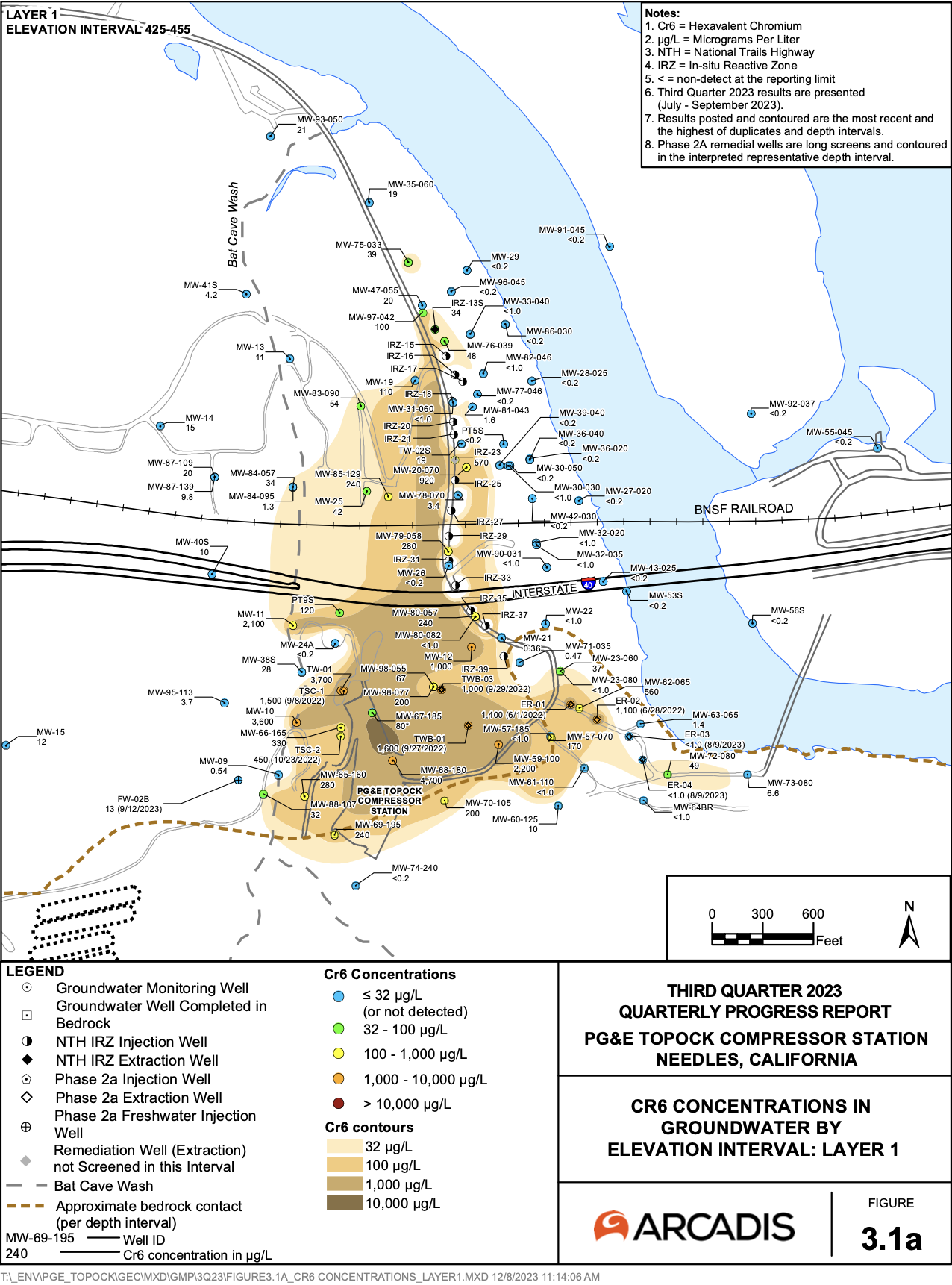
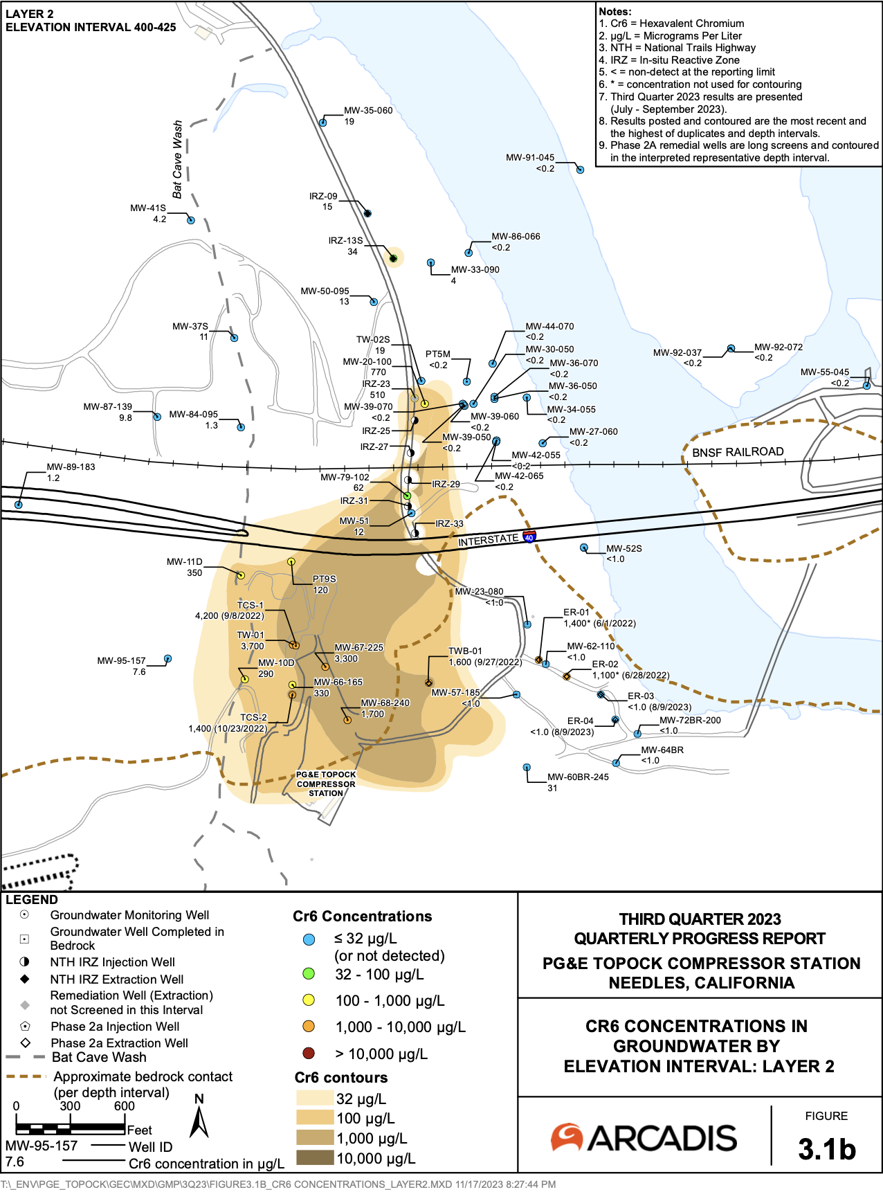
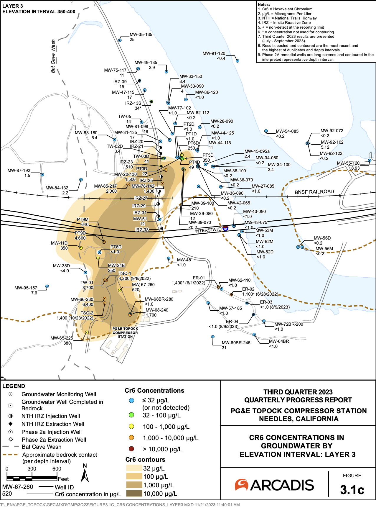
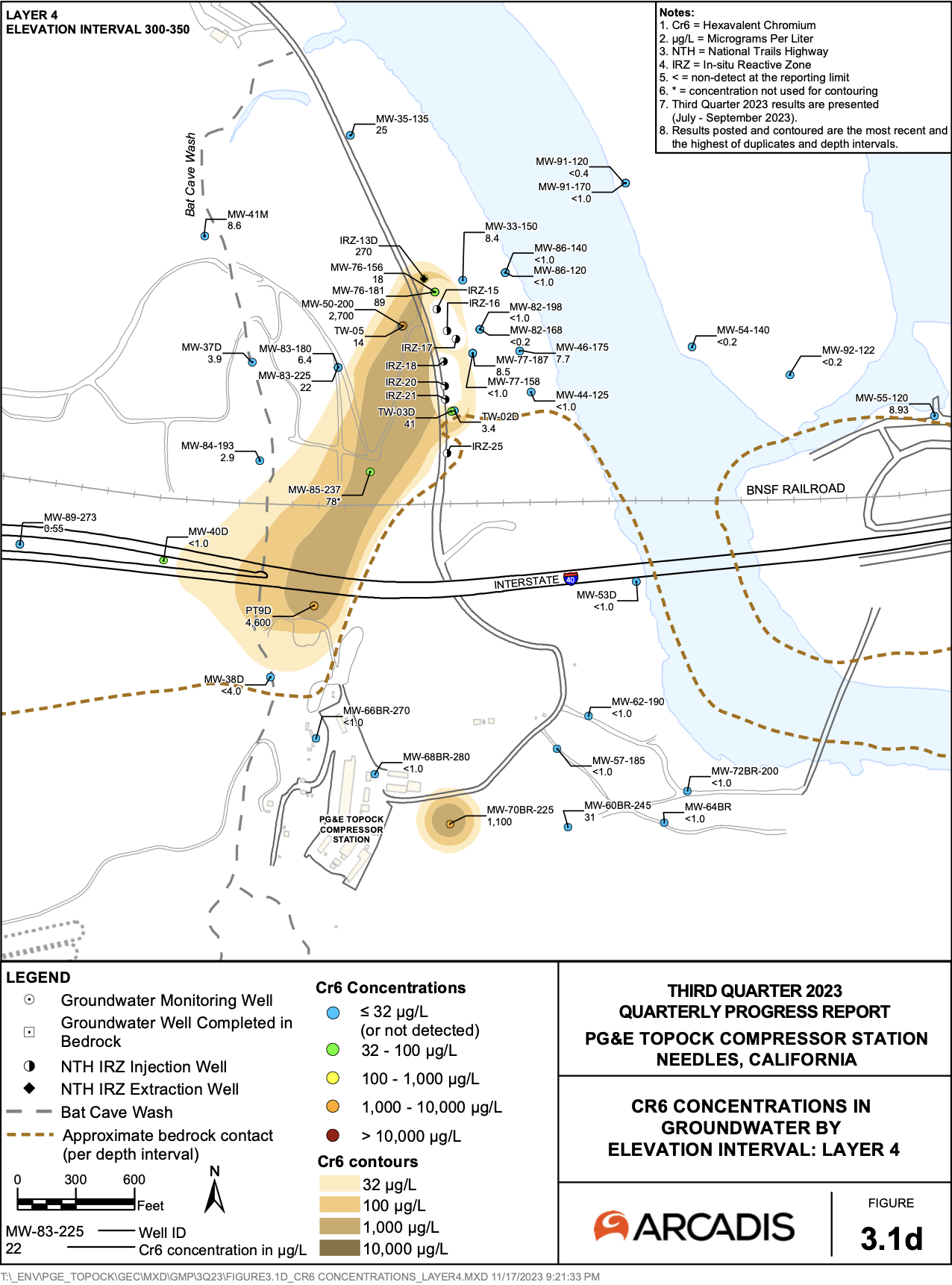
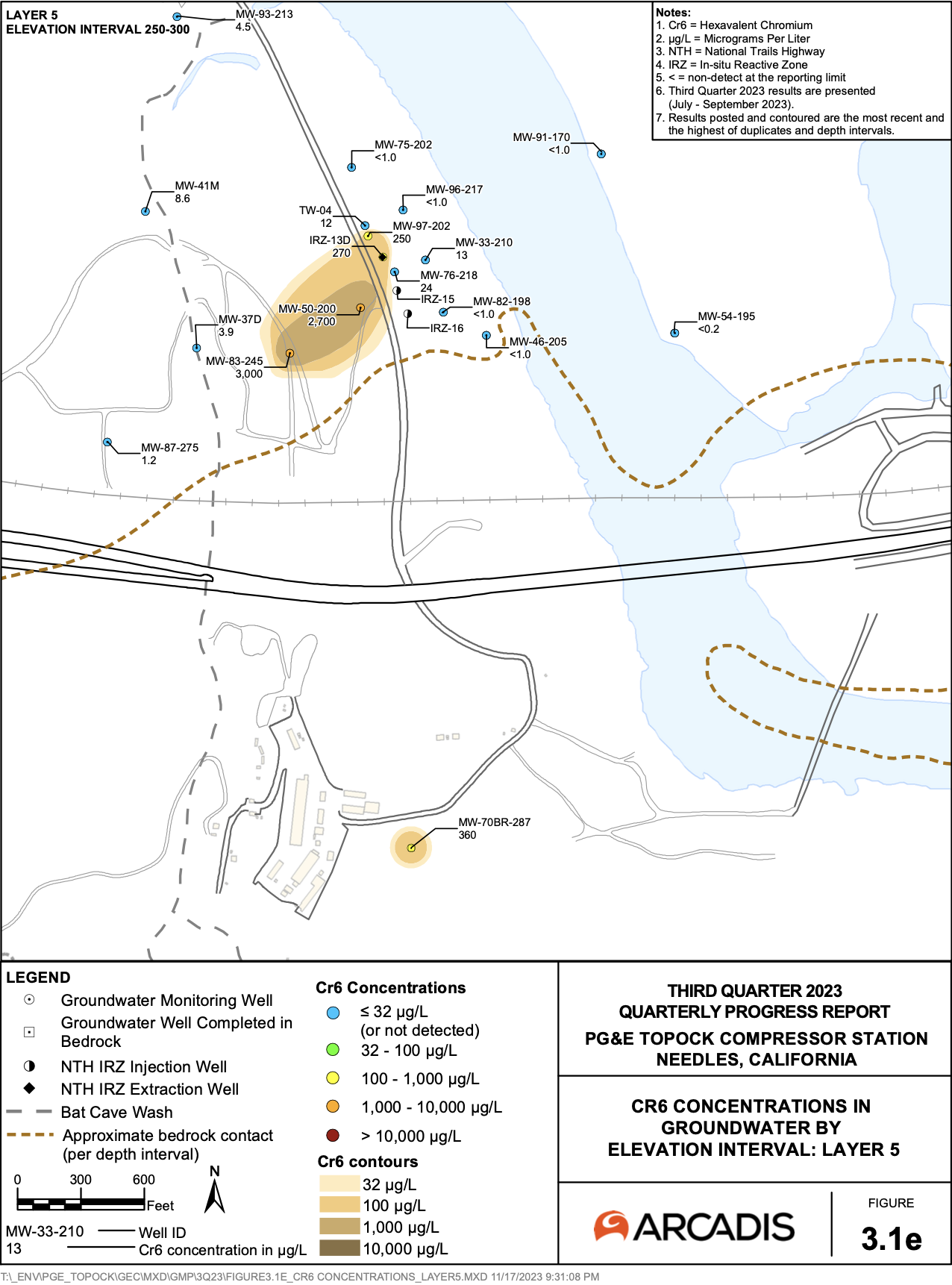
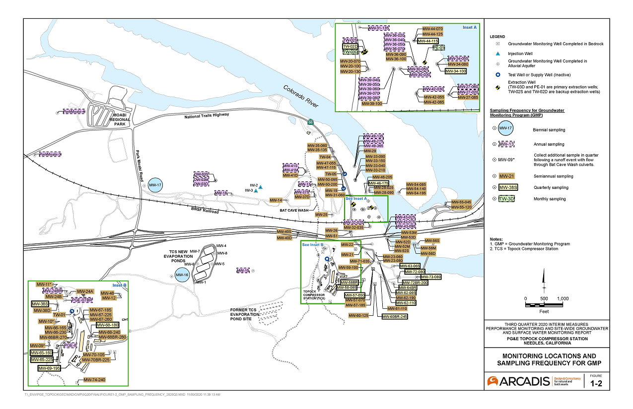
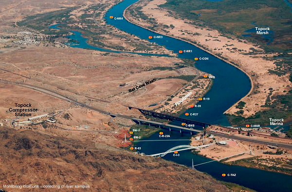
To view figures showing current groundwater and river sampling locations, or the most recent plume maps based on quarterly groundwater data, please click on the figures below.
Groundwater monitoring locations map and surface (river) water monitoring locations map:
(Click on images below for larger view)
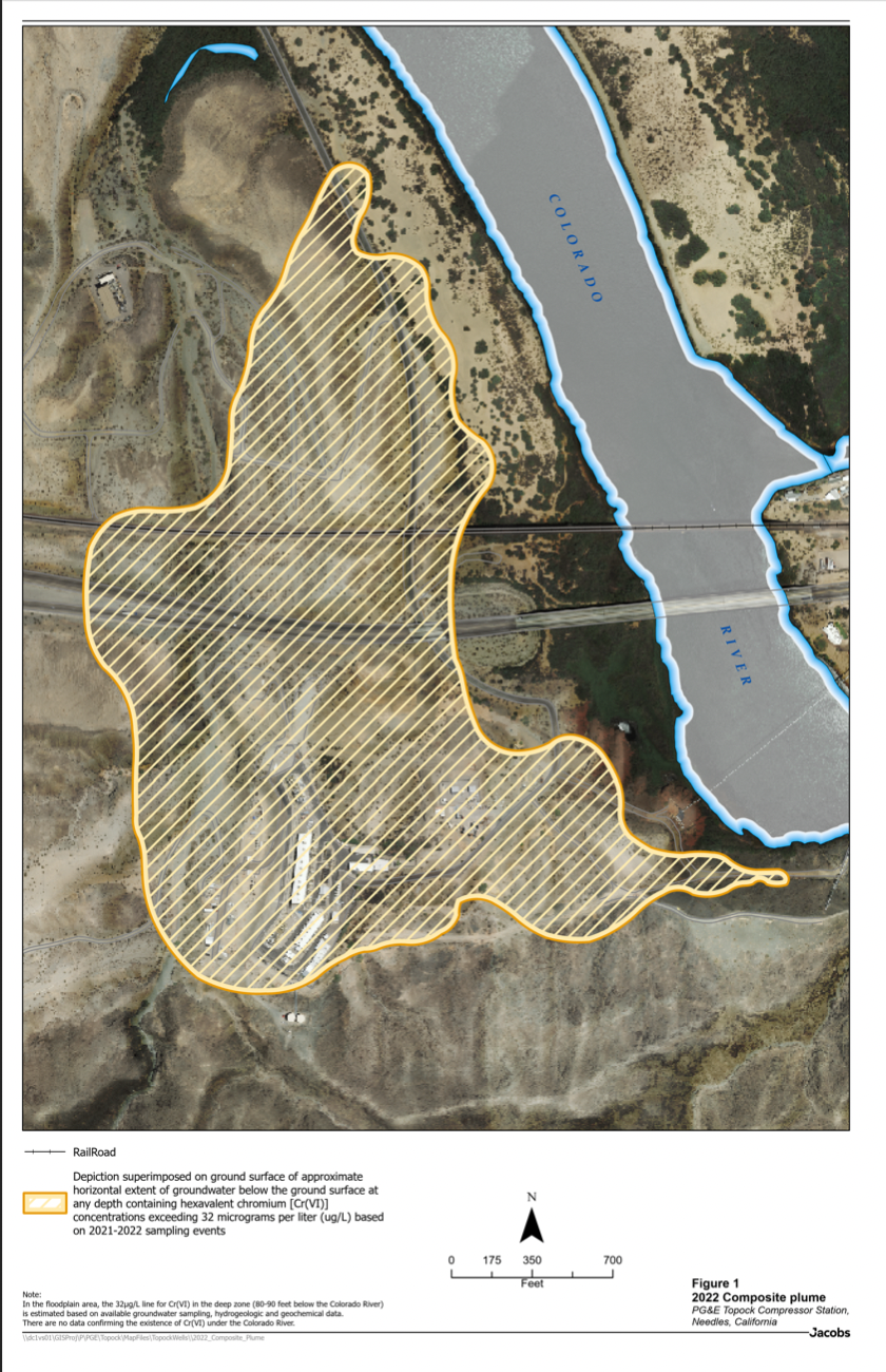
Plume maps, based on quarterly groundwater monitoring data show various depths on Layers 1 through 5: